Panguitch, Utah was intended to be a quick overnight on the road to Great Basin National Park in Nevada. But I wasn’t leaving Utah without a red rock hike, so we decided to hike the Pink Ledges to Photo Trail in Red Canyon on our way out of town.
Even though I was anxious for the final push to Great Basin, I needed the solace of the rocks. Life is hard sometimes, but hoodoos are a reminder that great beauty is revealed by the daily grind.
Ahh… the hoodoos. Okay, enough of my waxing poetic. Let’s get to the trail.

Early the next morning, we drove to Dixie National Forest to hike the sanctuary of the Pink Ledges and the Photo Trail in Red Canyon.
Getting to Red Canyon
Red Canyon, the little sister of Bryce, is located in Panguitch, Utah along Scenic Byway 12 within Dixie National Forest. A popular highway connecting Bryce Canyon and Capitol Reef National Parks, Scenic Byway 12 is a jaw-dropping must-do drive for anyone visiting Utah’s Mighty 5.
Begin Pink Ledges at the Red Canyon Visitor Center
The Pink Ledges to Photo Trail is an easy 2.3 mile (3.7 km) hike that begins at the Red Canyon Visitor Center. We started our hike at the Podunk Guard Station. You can pick up an interpretive guide and map for the trail in the visitor center. We were able to complete our hike in 1.5 hours including time for lots of photos.

I suggest hiking this trail early in the morning for a quieter, Zen-like experience. Although the trail is close to the highway, it feels more remote, especially if the traffic hasn’t ramped up for the day.

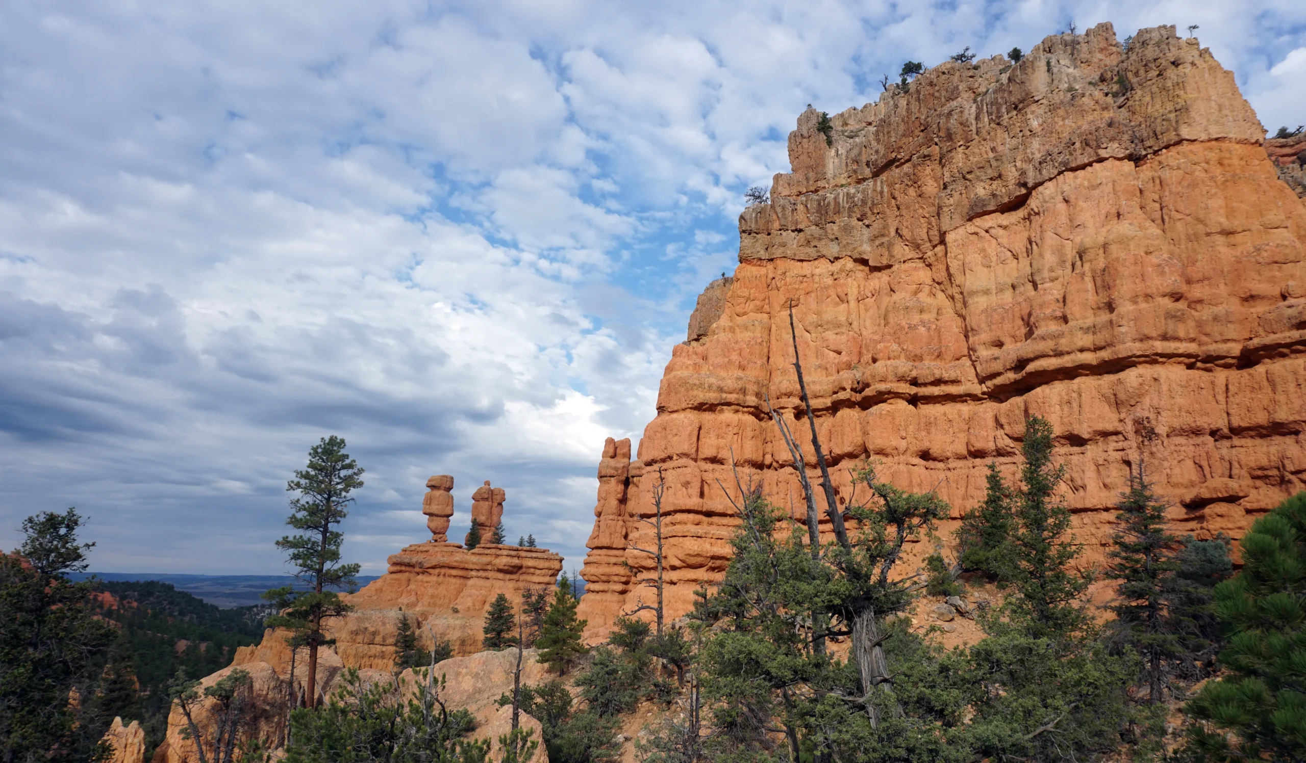
Follow the Pink Ledges Trail to the Photo trailhead by connecting with Hoodoo and Birdseye. (This is why getting a trail map at the visitor center is a good idea.) Have your camera ready! The temple of red rocks will stop you in your tracks. Commit these moments to memory.
Remembering is the catalyst for passion and passion is the key to a landscape’s immortality. –Bekah
Once you reach the Photo Trail, you’ll begin to climb to even better views. The Photo Trail is steep, narrow, and exposed, but we never felt uncomfortable and I’m typically afraid of heights. Take your time and watch your step, especially when descending. The loose rock can cause you to slide if you aren’t wearing proper footwear.

The U.S. Forest Service rates the Photo Loop as moderately challenging mainly due to the steep ascent on the Photo section. I ain’t gonna lie, it is a little steep, but the views are worth every heart-pumping step to the top.
*There is a small parking area on Scenic Byway 12 at the Photo trailhead allowing for direct access to the best views if you’re short on time or energy.
Return Trip
You can make the hike an out and back and return the same way you came, but we decided to cross Scenic Byway 12 at the Photo trailhead and return to the visitor center by way of the flat Red Canyon hike/bike path.
Make sure you stop in the visitor center to shop for souvenirs. I found some unique Smokey Bear merch and cool stickers for my travel cup. You can get a National Park Passport stamp here, too. Just so you know, the sites that aren’t really “National Parks” often have better stamps than the celebrities.
Don’t Miss These Red Canyon Photo Ops
If you’ve seen videos about Red Canyon and Scenic Byway 12, you’ve likely seen these iconic stone arches. They are literally gateways to adventure. I get an adrenaline rush every time I see them. You can pull off to the side of Scenic Byway 12 to get photos of the arches but be careful. There can be a lot of traffic, and those hoodoo views can easily distract drivers. Don’t be “hoo” they don’t see!

And then there’s Smokey Bear- aka “Smokey the Bear” which by the way is incorrect. (You can read about that in my article Smokey Bear Historical Park in Capitan, NM.) You’ll find this smokin’ big guy next to the Red Canyon Visitor Center sign. It’s become tradition for me to get a photo with Smokey every time we’re in Red Canyon.

Wander Over to Wanderlust Cowgirl in Panguitch
575 Center St., Panguitch, Utah
This tiny drive-thru coffee shop in the heart of Panguitch serves up the most luscious homemade orange rolls I’ve ever tasted. Get there early in the morning before they sell out. I promise, once you eat one of these babies, you’ll never want a grocery store whack-’em again! Don’t think about the calories. Think of them as an excuse to hike.

Wanderlust Cowgirl sells a variety of baked goods and breakfast items along with a good selection of hot/cold beverages. I especially enjoyed Wanderlust Cowgirl’s chai latte.
Hike Red Canyon’s Pink Ledges to Photo Trail!
Whether you’re staying awhile or passing through, make Pink Ledges to Photo Trail in Utah’s Red Canyon part of your plans. “Little Bryce” is a big deal you’ll never forget!
Do you have a favorite red rock hike you’d recommend? Contact me with your suggestions. I’m always looking for new adventures!
From the Library
Red- Passion and Patience in the Desert by Terry Tempest Williams broke me open, filled all my doubting spaces, and bestowed fresh blessings with every turn of the page.

Terry Tempest Williams masterfully blends practical wisdom, political scholarship, and romance in this collection of essays honoring the red rock region of the American southwest. The desert is more than a geological, ecological, and cultural resource. It is a powerful psychological resource for those desperate enough to see beyond its disguise.
“When one of us says, ‘Look there’s nothing out there,’ what we are really saying is, ‘I cannot see.‘” – Terry Tempest Williams
Comments